
From Drought to Deluge: How Water Systems Can Handle Both Floods and Droughts
How integrated water management helps communities prepare for both drought and flooding



From Drought to Deluge
How integrated water management helps communities prepare for both drought and flooding
 Drought Control
 WaveSave
 04 March 2025
 Reading time: 5 minutes
As climate change intensifies, communities worldwide are experiencing increasingly unpredictable water-related challenges—from devastating floods to prolonged droughts, often in the same regions within short timeframes. This “drought to deluge” pattern demands a fundamental shift from reactive crisis management to proactive, integrated water management solutions.


How can communities effectively prepare for both water scarcity and excess? Traditional water management approaches have typically addressed flooding and drought as separate challenges with distinct solutions. However, climate change has blurred these lines, creating a need for integrated systems that can quickly adapt to rapidly changing conditions.
Weather-related hazards dominate disaster statistics. A UN review of the years 1995–2015 found that 90% of major disasters were caused by floods, storms, heatwaves, droughts and other weather-related events, with floods alone making up 47% of the weather-related disasters.
Research also shows that rapid swings between very dry and very wet conditions are becoming more common. A 2025 review in Nature Reviews Earth & Environment reports that this “hydroclimate whiplash” has increased since the mid-twentieth century and is expected to increase further with warming. Worldwide, about one in nine droughts is followed by an unusually wet season, with clear local hotspots.
For water managers, this means floods and droughts can no longer be planned in separate silos.
.


A water system that copes with both extremes does three things: it slows water down, it stores excess water where it can be used later, and it is managed on the basis of shared data for both risks. Practical building blocks:
From our own work, four further points:
.
Much of the response to both extremes happens in the soil. When the soil surface is protected by crop residues, mulch or cover crops, more rain infiltrates and less runs off. That reduces erosion and downstream flooding during heavy rain, and leaves more water in the soil for dry spells.
FAO describes farmers in El Salvador who, after adopting such practices, harvested almost as much maize in the 1997 drought year as in a normal year, which they attributed to better soil moisture. The same field practices that reduce runoff in the wet season help crops through the dry season.
At landscape scale, the same principle appears in floodplains that are allowed to flood and store water, in buffer strips along watercourses and in retention areas: measures the Environment Agency describes as “working with natural processes”. Combined with water storage and early warning, they form the “integrated” part of integrated water management.
The same land and water measures work across the whole year. A simple way to plan them:
| When | Measures | Why it helps |
|---|---|---|
| Before the rains | Keep the soil covered with crop residues, mulch or cover crops; prepare temporary storage and agree on warning thresholds | More rain soaks in and less runs off; storage and warnings are ready when they are needed |
| During heavy rain | Let floodplains and retention areas take water; protect critical spots with temporary barriers; act on warnings | Water is held where it does the least harm (“working with natural processes”, Environment Agency), and damage at critical spots is limited |
| In the dry season | Use stored water for irrigation; keep soil cover in place | Crops get water when rain fails, as in the Burundi project; covered soil keeps its moisture, as FAO describes for El Salvador |
Treating floods and droughts as one continuum means one risk assessment for both extremes; storage and release rules that serve both, keeping capacity free before the wet season and retaining water before the dry season; and measures with a double effect, such as retention, infiltration and floodplains.
Hydroclimate research suggests that the switch between extremes is getting faster. That makes the combination of forecasting, flexible measures and storage more valuable than single-purpose infrastructure alone.
Burundi: CTCN/UNEP Climate Adaptation Project
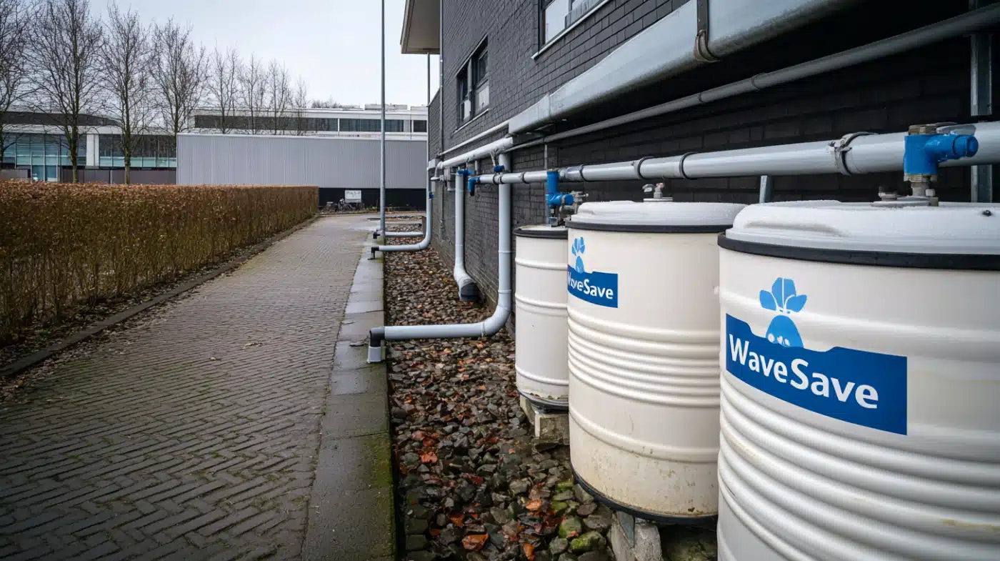
In Burundi, a country facing increasing climate volatility, the Climate Technology Centre and Network (CTCN) and UN Environment Programme (UNEP) funded an innovative water management project implemented by WaveSave. The project addressed the dual challenges of seasonal flooding and prolonged dry periods in vulnerable agricultural Mpanda Commune in the Bubanza Province.
The implementation included:
The Burundi project page reports prevented flood damage to homes and land, water storage for irrigation and improved agricultural yields.
The Netherlands: Room for the River
After the high-water events of the 1990s, the Netherlands gave its main rivers more space instead of only raising dikes. Measures included relocating dikes, lowering floodplains and digging high-water channels at 34 locations; the programme was completed in 2019.

 Kenya
 The Netherlands
 Kenya
 Kenya
 Burundi
 The Netherlands
 Burundi
 Kenya
 Cuba
 The Netherlands
 Pakistan
 Uganda
 Burundi
 Fiji
 Iceland
 Nigeria
 Fiji
 Burundi
 Pakistan
The path to true climate resilience requires moving beyond treating floods and droughts as separate challenges. Integrated water management—combining flexible infrastructure, real-time data, predictive analytics, and community engagement—offers a sustainable approach to our increasingly unpredictable climate reality.
WaveSave’s comprehensive solutions provide communities with the tools they need to navigate both water scarcity and excess. By implementing systems that can quickly adapt to changing conditions, we help build resilience that extends beyond individual disaster responses to create truly sustainable water management. As climate patterns continue to shift, this integrated approach will become not just beneficial but essential for community survival and prosperity.
.
.
Traditionally, drought and flood management have been handled separately by different agencies with distinct infrastructure and planning processes. This siloed approach often results in missed opportunities, as flood control typically focuses on moving water away quickly while drought management centers on water retention. Integrated systems recognize that excess water during floods can be captured and stored for use during dry periods.
Mobile flood barriers like SLAMDAM add flexibility alongside permanent structures. They can be deployed where needed during flood events, then removed or reconfigured to create temporary water retention areas. This adaptability helps as climate patterns become more unpredictable and communities need solutions that can adjust to rapidly changing conditions.
Advanced monitoring systems collect data on rainfall, soil moisture, water levels, and weather patterns to give earlier warning of both flooding and drought. How far ahead depends on the hazard and the forecasting system: flash floods may leave only hours, while droughts develop more slowly. Earlier warning allows communities to deploy mobile barriers before flooding occurs and implement water conservation measures before drought conditions become severe. The same data infrastructure can serve both purposes.
Community engagement is essential for successful implementation. Local knowledge helps identify historical flood pathways and vulnerable areas that might not appear on maps. Community participation in planning ensures solutions address local priorities and concerns. Additionally, trained community members can assist with rapid deployment of mobile barriers and help maintain local monitoring systems.
Integrated approaches can be more cost-effective than separate systems for flood and drought management, because data, storage and staff serve both risks. Many communities find success through phased implementation, beginning with critical infrastructure protection and expanding over time. Numerous funding sources exist specifically for climate resilience projects, including national adaptation funds, development bank financing, and public-private partnerships. Avoided disaster recovery costs are part of the business case.
Climate change is increasing both the frequency and intensity of extreme weather events while making patterns less predictable. Some regions now experience severe flooding and prolonged drought within short timeframes. This “weather whiplash” overwhelms traditional single-purpose water systems but can be addressed through flexible, integrated approaches that can quickly adapt to changing conditions.
Integrated approaches typically work with natural systems rather than against them. By creating controlled flooding areas that mimic natural floodplains, these systems support biodiversity, groundwater recharge, and ecosystem health. Compared to traditional concrete-heavy infrastructure, integrated solutions can have lower carbon footprints and create fewer disruptions to natural water flows and habitats.
Implementation timelines vary based on complexity and scope. Communities often begin with high-priority components that can be deployed within months, such as mobile flood barriers and basic monitoring systems. Full integration of governance structures, complete monitoring networks and community training takes longer and depends on the local situation. Some benefits can begin once the first components are operational, with resilience increasing over time as the system matures.

Want to discuss your flood or drought challenge?
.blog-wrapper.blog-single.page-wrapper {
padding: 0px;
}
body.post-template-default.single.single-post .header-wrapper div#masthead .header-inner.flex-row.container.logo-left.medium-logo-center .flex-col.hide-for-medium.flex-right ul.header-nav.header-nav-main.nav.nav-right.nav-size-xlarge.nav-spacing-xlarge li.html.custom.html_topbar_right .common-white-btn a
{color:#fff !important;}
body.post-template-default.single.single-post .header-wrapper div#masthead .header-inner.flex-row.container.logo-left.medium-logo-center .flex-col.hide-for-medium.flex-right ul.header-nav.header-nav-main.nav.nav-right.nav-size-xlarge.nav-spacing-xlarge li.html.custom.html_topbar_right .common-white-btn img{filter:brightness(100);}
